Spectra Precision ProMark 800 GNSS Glonass receiver, state of the art GNSS technology in a smart, compact, light weight, cable free modular design
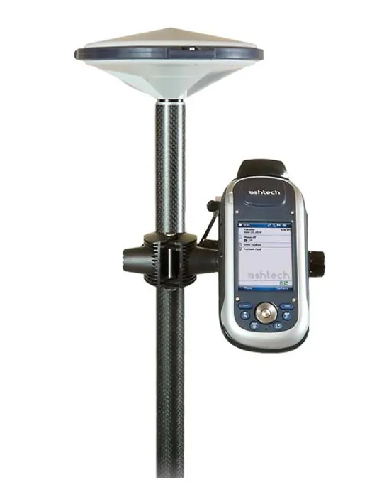
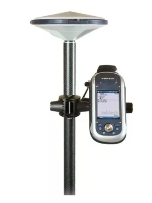
ProMark 200 Network RTK Rover includes :
- ProMark 200 GNSS Receiver
- L2, GLONAS
- HI Measurement Tape
- Fast Survey
- Docking Station
- GSM Modem
- Pole Bracket
- GNSS Solutions
- GNSS antenna
- Vertical Ant. Extension
- Field System Bag
The ProMark 200 is the most cost-effective dual-frequency network RTK solution.
Embedded BLADE technology provides outstanding, long range RTK performance, fast initialization and centimeter-level accuracy. Together with the comprehensive Spectra Precision FAST Survey™ field software, the ProMark 200 meets the demanding expectations from professional land surveyors.
Spectra Precision ProMark 200 RTK rover includes extended wireless network communications, large memory, fast processor, Windows Mobile 6.5 operating system; all in a lightweight and very rugged handheld form factor for maximum mobility. The mix of exceptional RTK performance and compact design makes the ProMark 200 an extremely powerful and appealing network RTK rover solution.
FAST Survey Field SoftwareFAST Survey Field Software
Advanced FAST Survey field software meets the most demanding survey requirements. It includes topographic features typically associated with dual frequency, and provides extensive data formats and local coordinate system support. Added options make it interwork with a wide range of survey instruments and accessories to run complete survey jobs, including site calibration, stake out, and survey projects where total stations are used.
GNSS Solutions Office Software
GNSS Solutions is a comprehensive software package that provides all the tools necessary to successfully process GNSS survey data. It includes advanced error detection and quality analysis tools to ensure accurate and reliable results. Loop closures, automatic repeat, observation analysis, and least-squares adjustments are integral components of the software. Raster and vector map formats can be imported to enable background maps to be combined with land survey projects and to prepare stake out missions in the office.