
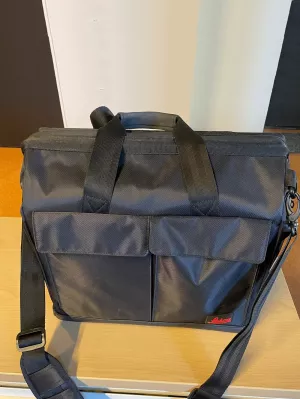
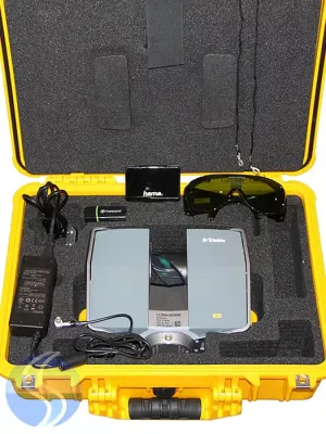
Used Leica BLK360 Laser Scanner for sale includes BLK360 Mission kit, Cyclone REGISTER, Cyclone REGISTER CCP 12 subscription, Cyclone REGISTER 360
Get started out of the box to work with point cloud data on your computer, this Leica BLK360 comes with BLK360 Mission kit, Leica Cyclone REGISTER 360 (BLK Edition). Cyclone REGISTER 360 (BLK Edition) to provides streamlined point cloud registration workflows to assist new users and speed the process for experienced users.
Leica Cyclone REGISTER 360 (BLK Edition) is a simplified version of Leica Cyclone REGISTER. It features an intuitive UI, guided workflows and an easy process for sharing data downstream with more advanced tools like JetStream and TruView. Alternatively, export your cloud as a standard E57 file or Autodesk’s native RCP file format.
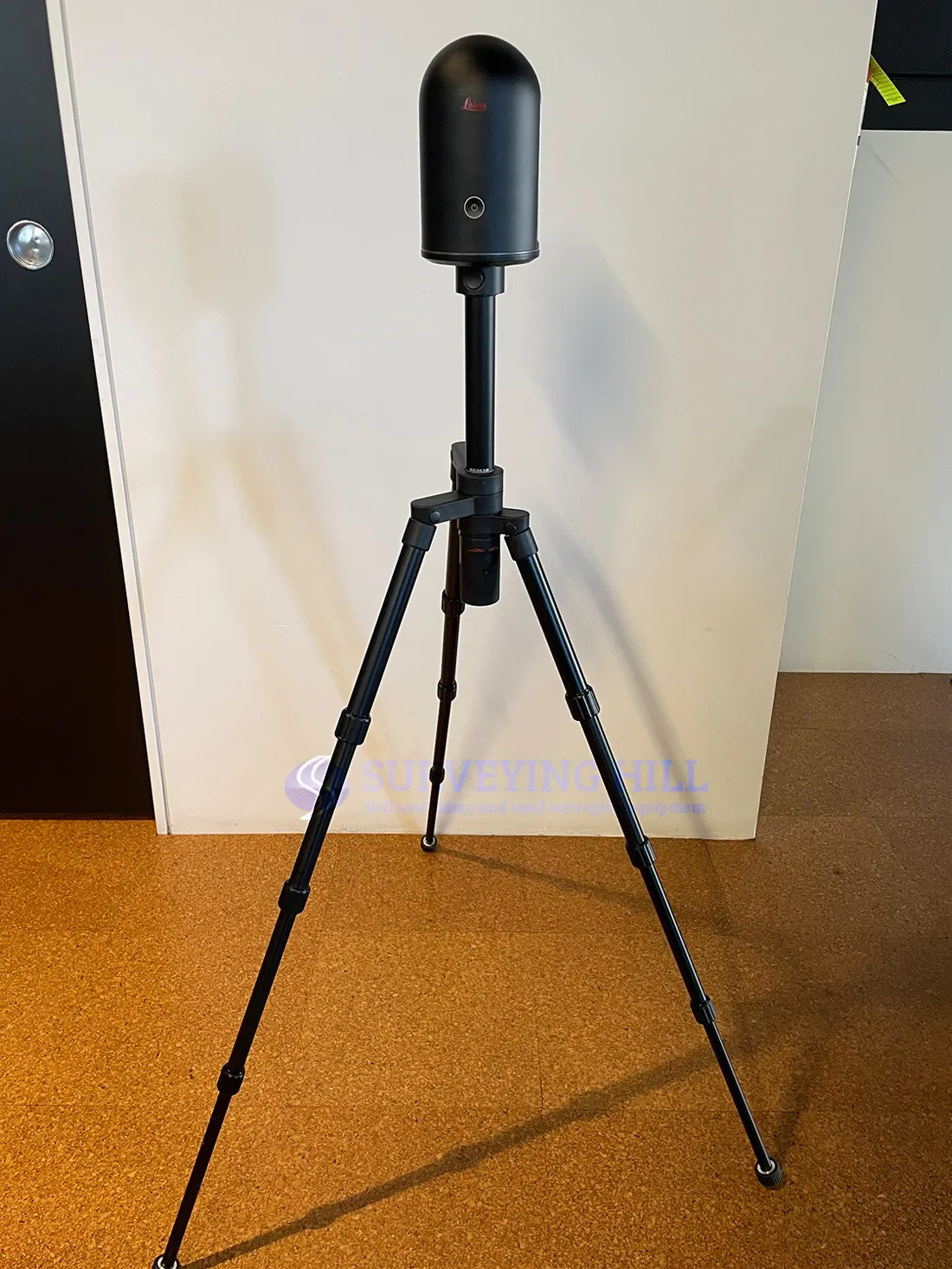
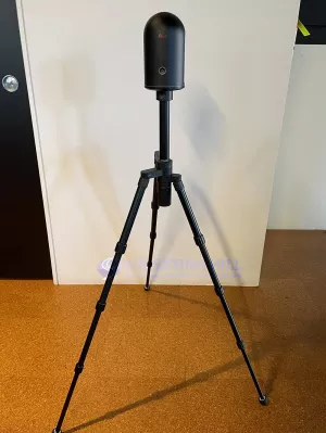
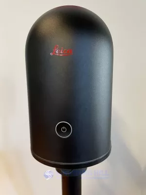
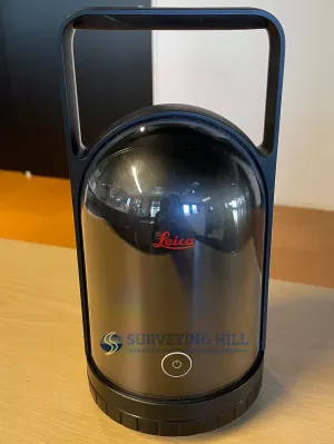
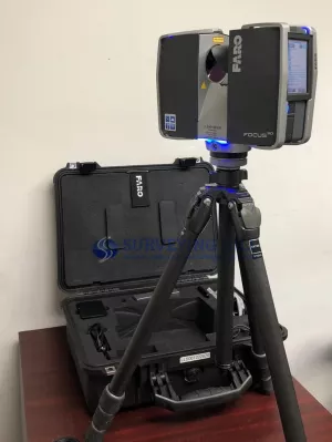
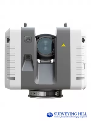
The Leica BLK360 Laser Scanner is an imaging laser scanner for both beginners and professionals.
The Leica BLK360 captures the world around you with full-colour panoramic images overlaid on a high-accuracy point cloud. Simple to use with just the single push of one button, the BLK360 is the smallest and lightest of its kind. Anyone who can operate an iPad can now capture the world around them with high resolution 3D panoramic images.
The BLK360 represents the confluence of art and engineering.
- Fast image and point cloud processing
- Lightweight, portable and easy to carry around
- Easy to use one-button scanning
- Enhanced connectivity and collaboration capabilities with cloud sync
- Two-in-one 360º image documentation and laser scan data
- Reality capture data integration with Autodesk’s design solutions
The Leica BLK360 designed to help new-to-LiDAR users capture point clouds and unlock the potential of using them in many different applications. Ranging from practical uses, such as architecture and surveying, to creative possibilities, such as VR workflows and media location scouting, the BLK360 G1 is meant to make reality capture accessible to everyone.
The BLK360 captures 360,000 points per second, panoramic HDR imagery, and has thermal imaging capability. It is fully compatible with the Leica Cyclone suite of Reality Capture software and powerful enough to be a useful addition to an experienced surveyor’s toolkit.
Software options for every kind of project. For larger projects or existing Cyclone users, Leica Cyclone REGISTER 360 and Cyclone FIELD 360 are also available to help register your scans together and view scan data and imagery in real-time.
Leica BLK360 Specifications:
|
GENERAL |
|
| Imaging scanner | 3D scanner with integrated spherical imaging system and thermography panorama sensor system |
| DESIGN & PHYSICAL | |
| Housing | Black anodized aluminium |
| Dimensions (H x D) | 165 x 100 mm |
| Weight | 1 kg |
| Transport cover | Hood with integrated floorstand |
| Mounting mechanism | Button-press quick release |
| OPERATION | |
| Stand-alone operation | One-button operation |
| Remote operation | iPad app, Apple iPad Pro® 12.9”/iOS 10 or later |
| Wireless communication | Integrated wireless LAN (802.11 b/g/n) |
| Internal memory | Storage for > 100 setups |
| Instrument orientation | Upright and upside down |
| POWER | |
| Battery type | Internal, rechargeable Li-Ion battery (Leica GEB212) |
| Capacity | Typically >40 setups |
|
SCANNING |
|
| Distance measurement system | High speed time of flight enhanced by Waveform Digitizing (WFD) technology |
| Laser class | 1 (in accordance with IEC 60825-1:2014) |
| Wavelength | 830 nm |
| Field of view | 360° (horizontal) / 300° (vertical) |
| Range* | min. 0.6 - up to 60 m |
| Point measurement rate | up to 360’000 pts / sec |
| Ranging accuracy* | 4mm @ 10m / 7mm @ 20m |
| Measurement modes | 3 user selectable resolution settings |
|
IMAGING |
|
| Camera System | 15 Mpixel 3-camera system, 150Mpx full dome capture, HDR, LED flash Cali brated spherical image, 360° x 300° |
| Thermal Camera | FLIR technology based longwave infrared camera Thermal panoramic image, 360° x 70° |
|
PERFORMANCE |
|
| Measurement speed | < 3 min for complete fulldome scan, spherical image & thermal image |
| 3D point accuracy* | 6mm @ 10m / 8mm @ 20m |
|
ENVIRONMENTAL |
|
| Robustness | Designed for indoor and outdoor use |
| Operating temperature | +5 to +40° C |
| Dust/Humidity | Solid particle/liquid ingress protection IP54 (IEC 60529) |
| DATA ACQUISITION | |
| Live image and scanned data streaming | |
| Live data viewing and editing | |
| Automatic tilt measurements | |